
View 360° Video and Imagery of Your Local Shorelines
Without Leaving the Office
Our 360° imagery allows for comprehensive review of shoreline property conditions, dock and boat numbers, seawall conditions, and more — all from your computer.
View Our 360° Imagery Below
IMPORTANT!
Our 360° panoramic sample video and images may not be compatible with your browser. If you encounter any issues viewing video mode or picture mode, try reloading the page. If the issue persists, please consider using a different browser or device, or click the button further down the page to view on Google Street View.
Video Mode
0:00
-0:00
Picture Mode
❮ Prev
Next ❯
1/8
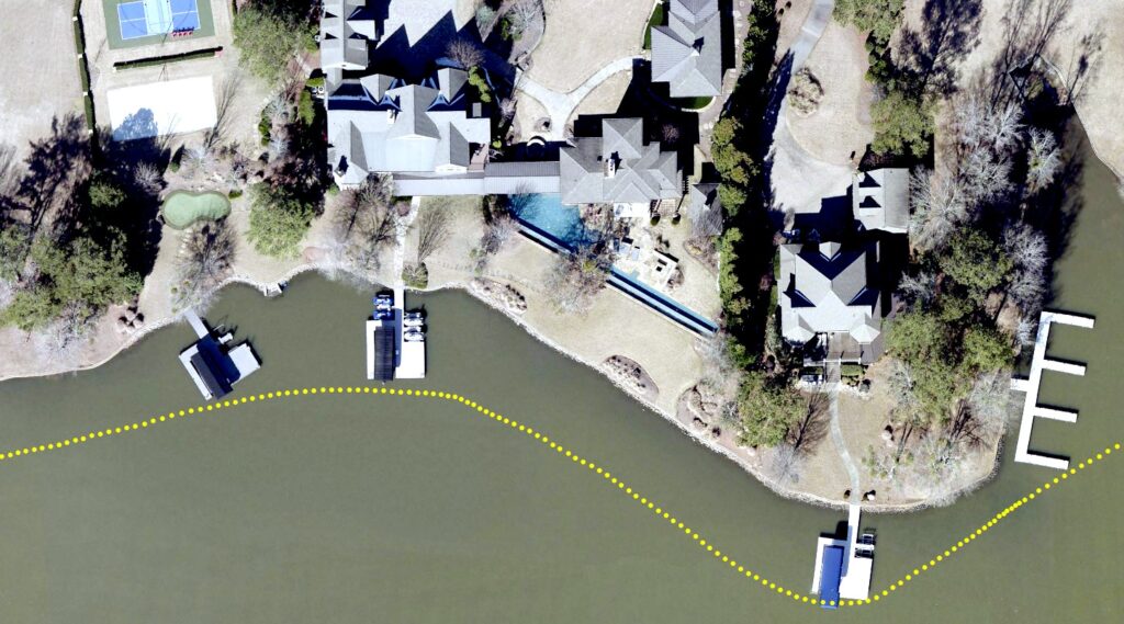
- Each image is geotagged (yellow dots) so you know exactly where it was taken
- Using your GIS software, click on any point/dot to open the picture
- Points (shown as yellow dots in images) delivered in shapefile and/or geodatabase format
- Integrates easily with other GIS data layers
Features of ShoreView360's Imagery
- Access to seamless, 360° panoramic views of shorelines
- Online and offline viewing options
- Local copies available for offline viewing
- Local copies contain NO intentional blurring
- Delivery in 360 video and 360 picture formats
- Coorindates imbedded into each video and image
- Seamless integration of images with existing GIS data layers
- Each image available via point shapefiles and hyperlink functionality
- Images publicly accessible via Google's Street View® application (upon request)
- Google automatically applies online blurring algorithm to bystanders (good thing)
- Captured in 8K resolution at 5 frames per second
- Project scope scalable to meet your budget
Useful For
- Verification of dock numbers and boat numbers, when visible
- Verifying conditions of seawalls, docks, and other shoreline improvements
- Viewing rear of house and inspect for additions or improvements
- Clearly viewing mechanical improvements such as lifts
- Viewing water depth at docksides (upon request)
- Assessing quality of view from dockside
- Assessing shore appeal
- Residents and prospective buyers can take virtual boat tours from home
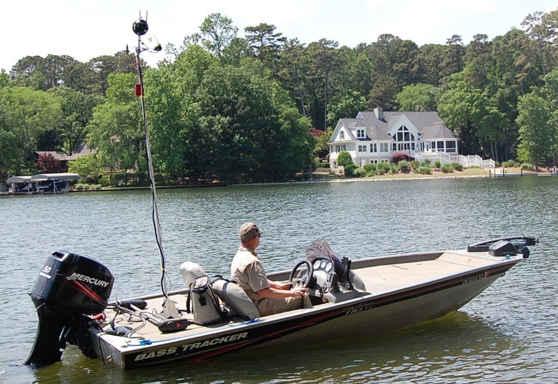
About Our Camera System
- Mounted on telescoping pole and leveled with custom gimbal system
- 6 lenses, simultaneous capture, 360° coverage
- Built-in GPS and Wi-Fi remote control with external antennas
- Video capture, delivered as video and pictures
Customer Quotes
"ShoreView360 is essential. It's like having an instant field appraiser in a boat on site at every lake property. Any concerns about water depth, view, and/or conditions of boat docks and seawalls are answered immediately."
- Chuck Anglin, Chief Appraiser of Putnam County, Georgia
Copyright © 2026 ShoreView360. All rights reserved.